Spring term
Year 3
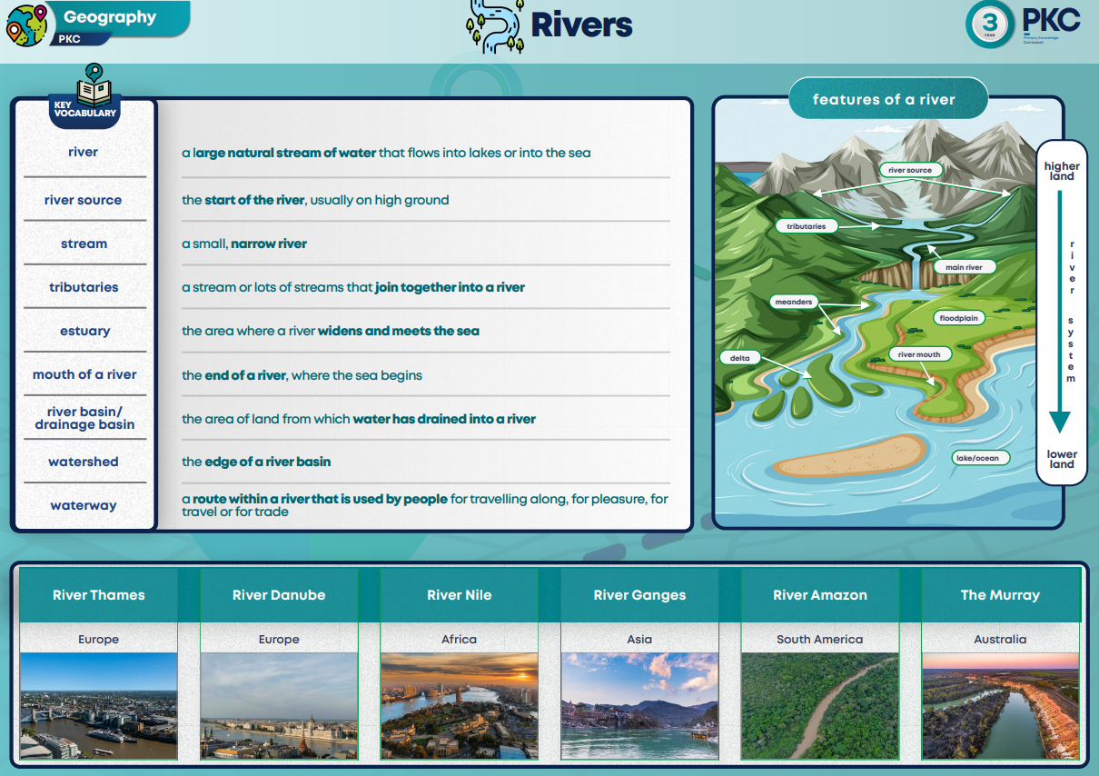
Rivers
In this unit, children will develop their understanding of how people interact with the world around them. They will explore how people use rivers, for example for irrigation for farmland, for transport and as a water supply. They will consider the impact of less than normal rainfall on rivers, specifically the Mississippi River, and then in turn the impact that a drought can have on the people who rely on the river. As the National Curriculum requires, children will be using maps, atlases, globes and digital/computer mapping to locate the rivers, the countries they journey through and to describe their features, particularly their shape and direction of travel. In this unit children will use atlases to locate continents and countries. They will identify rivers and locate the countries the rivers run through.
Year 4
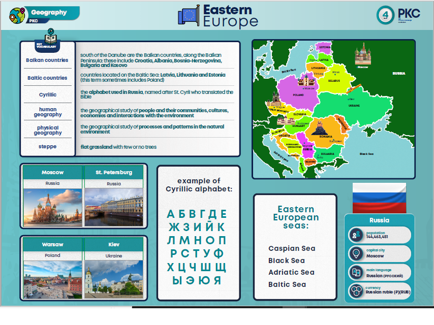
Eastern Europe
In this unit, children will explore the countries of Eastern Europe and key features such as rivers and climate. They will compare the UK with a chosen European country. Children will then study the recent conflict in Ukraine and explore the impact on the rest of Europe. They will locate Crimea on a map of Eastern Europe and discuss why its geography has led to many different conflicts over time. As required by the National Curriculum, children will use maps and atlases to locate countries and features of Eastern Europe. They will use their prior knowledge of regions of Europe to identify countries.
Year 5
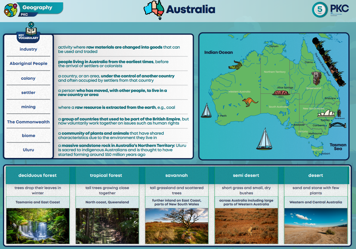
Australia
Within this unit children will use maps of Australia to identify key settlements, such as the capital city of Canberra, and identify biomes and rivers. They will study physical aspects of Australia’s geography, such as the desert, the tropical rainforests, the mountains and the rivers. They will learn about the importance of Uluru and how it is respected by the Aboriginal people of Australia as a sacred site. They will learn about the climate and how unreliable rainfall causes problems for people who depend on water for irrigation and farming. Using population maps, children will locate areas of dense population and major settlements within Australia. They will consider the physical geography of the country and reflect upon the position of major settlements and how the two factors are related. Throughout this unit, children will form an understanding that Australia is a diverse place, and is home to contrasting landscapes, including rural and urban environments.
Year 6
North America
This unit builds on children’s understanding of world geography and focusses on the continent of North America. Following this unit, children will study South America, Africa and finally, a unit that builds on all of their previous knowledge of Geography; Globalisation. Children’s understanding of biomes will be developed in this unit as they look at the tundra in the northern parts of the continent and the tropical forests of the southern parts of the continent. Children will build on their map skills as they explore maps of North America and develop their research skills using online map tools.
